


Gamay (Saint-Aubin)

pensionisten71
User
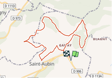

Length
11.4 km

Max alt
470 m

Uphill gradient
342 m
Km-Effort
16 km

Min alt
261 m

Downhill gradient
342 m
Boucle
Yes
Creation date :
2020-01-23 12:33:42.979
Updated on :
2020-01-23 15:37:09.621
3h01
Difficulty : Easy

FREE GPS app for hiking
 SityTrail
IGN / Geographical institutes
SityTrail Plus
The world is yours!
About
Trail Walking of 11.4 km to be discovered at Bourgogne-Franche-Comté, Côte-d'Or, Saint-Aubin. This trail is proposed by pensionisten71.
Description
Belle balade
Positioning
Country:
France
Region :
Bourgogne-Franche-Comté
Department/Province :
Côte-d'Or
Municipality :
Saint-Aubin
Location:
Unknown
Start:(Dec)
Start:(UTM)
631273 ; 5201180 (31T) N.
Comments