


sentier au fil de l'eau

Michel DUBOIS
User
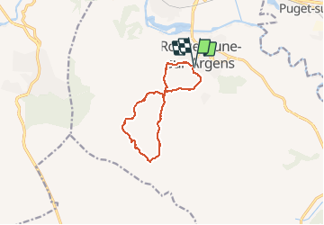

Length
10.7 km

Max alt
259 m

Uphill gradient
334 m
Km-Effort
15.2 km

Min alt
22 m

Downhill gradient
342 m
Boucle
Yes
Creation date :
2020-01-27 07:51:43.106
Updated on :
2020-01-27 11:21:47.869
3h09
Difficulty : Very easy

FREE GPS app for hiking
 SityTrail
IGN / Geographical institutes
SityTrail Plus
The world is yours!
About
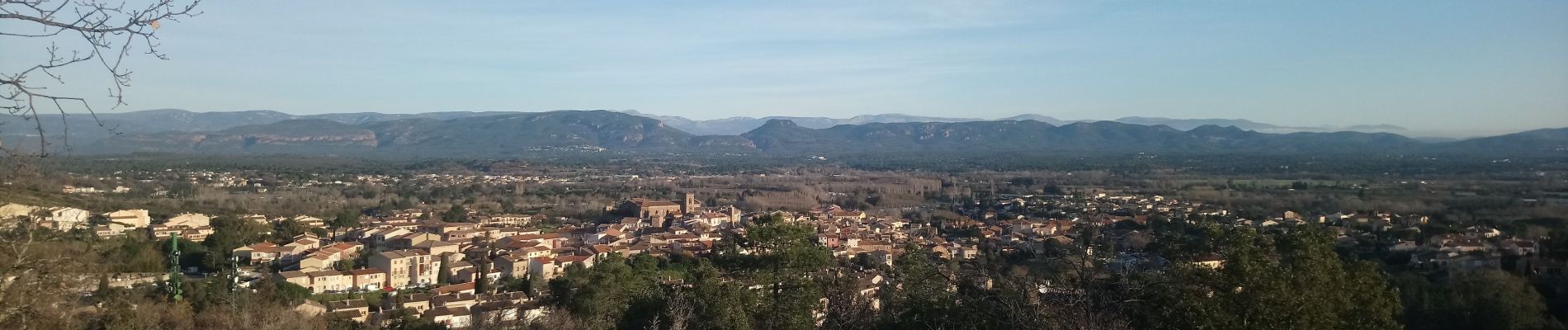
Trail Walking of 10.7 km to be discovered at Provence-Alpes-Côte d'Azur, Var, Roquebrune-sur-Argens. This trail is proposed by Michel DUBOIS.
Photos


Positioning
Country:
France
Region :
Provence-Alpes-Côte d'Azur
Department/Province :
Var
Municipality :
Roquebrune-sur-Argens
Location:
Unknown
Start:(Dec)
Start:(UTM)
308507 ; 4812358 (32T) N.
Comments