


ils de la jatte

GOELERANDO2
User

Length
5.9 km

Max alt
62 m

Uphill gradient
73 m
Km-Effort
6.9 km

Min alt
0 m

Downhill gradient
99 m
Boucle
No
Creation date :
2020-01-21 12:43:11.715
Updated on :
2020-01-28 14:12:27.153
2h01
Difficulty : Very easy

FREE GPS app for hiking
 SityTrail
IGN / Geographical institutes
SityTrail Plus
The world is yours!
About
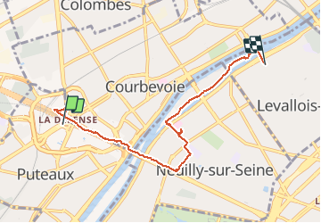
Trail Walking of 5.9 km to be discovered at Ile-de-France, Hauts-de-Seine, Puteaux. This trail is proposed by GOELERANDO2.
Description
rando
Positioning
Country:
France
Region :
Ile-de-France
Department/Province :
Hauts-de-Seine
Municipality :
Puteaux
Location:
Unknown
Start:(Dec)
Start:(UTM)
444317 ; 5415564 (31U) N.
Comments