Trail On foot Saint-Alban-d'Ay - Roiffieux, Citerne du Grand Garay, La Roche des Vents - Photo

Roiffieux, Citerne du Grand Garay, La Roche des Vents

 tartane1
tartane1

User

© OpenStreetMap contributors
Length
Length
9.7 km
Max alt
Max alt
997 m
Uphill gradient
Uphill gradient
461 m
Km-Effort
Km-Effort  
15.9 km
Min alt
Min alt
622 m
Downhill gradient
Downhill gradient
464 m
Boucle
Boucle
Yes
Creation date :
2020-01-30 14:02:17.138
Updated on :
2021-01-24 18:01:28.545

(0 Reviews)

On foot
On foot
--
Difficulty : Difficult

Scan this QR Code to open this trail in the SityTrail application

FREE GPS app for hiking

Logo SityTrail SityTrail

IGN / Geographical institutes

Download SityTrail from the App Store Download SityTrail from Google Play

Logo SityTrail SityTrail World

The world is yours!

Download SityTrail from the App Store Download SityTrail from Google Play Download SityTrail on Huawei AppGallery

About

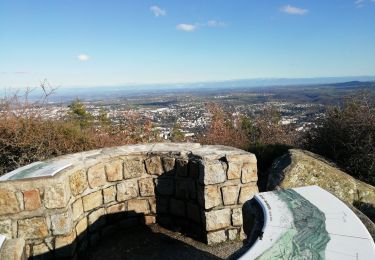
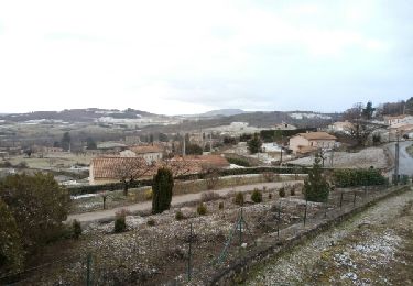
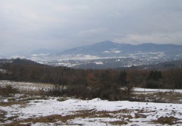
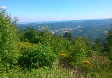
Trail On foot of 9.7 km to be discovered at Auvergne-Rhône-Alpes, Ardèche, Saint-Alban-d'Ay. This trail is proposed by tartane1.

Description

Rando sur des chemins forestiers.
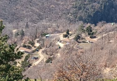
Départ à la citerne du Grand Garay (Roiffieux)
Le retour se fait par le même chemin avec détour par le hameau de Ménérol.
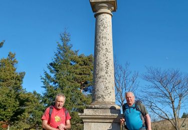
Rando plutôt difficile, compter  3 à 4h.

Elevation profile

Positioning

Country:
France
Region :
Auvergne-Rhône-Alpes
Department/Province :
Ardèche
Municipality :
Saint-Alban-d'Ay
Location:
Unknown
Start:(UTM)
627504 ; 5007579 (31T) N.

Trails nearby

Trail Walking Annonay - 07 Chatinay Montmiandon 3km 130m - Photo
Walking
SyMA

Walking

Very easy
(2)
Annonay, Auvergne-Rhône-Alpes, Ardèche, France
3 km | 4.8 km-effort
55min
Yes
Trail Walking Villevocance - la Mer de glace - Photo
Walking
jphugon

Walking

Difficult
Villevocance, Auvergne-Rhône-Alpes, Ardèche, France
11.9 km | 18.3 km-effort
6h 20min
Yes
Trail Walking Villevocance - 07 mer de glace Cx chirols - Photo
Walking
randodyssée

Walking

Medium
Villevocance, Auvergne-Rhône-Alpes, Ardèche, France
14.8 km | 23 km-effort
6h 5min
Yes
Trail Walking Villevocance - croix de chirol - Photo
Walking
jphugon

Walking

Very difficult
Villevocance, Auvergne-Rhône-Alpes, Ardèche, France
17.7 km | 27 km-effort
7h 4min
Yes
Trail Walking Saint-Alban-d'Ay - GRP Tour du bassin d'Annonay - Photo
Walking
Bgi

Walking

Medium
Saint-Alban-d'Ay, Auvergne-Rhône-Alpes, Ardèche, France
102 km | 145 km-effort
23h 36min
Yes
Trail Walking Saint-Alban-d'Ay - Suc de Vent - St Alban D''Ay - Photo
Walking
tracegps

Walking

Medium
Saint-Alban-d'Ay, Auvergne-Rhône-Alpes, Ardèche, France
24 km | 36 km-effort
8h 0min
Yes
Trail Mountain bike Annonay - Tour du Suc Des Vents - Photo
Mountain bike
CyrilM

Mountain bike

Difficult
Annonay, Auvergne-Rhône-Alpes, Ardèche, France
43 km | 60 km-effort
3h 21min
Yes
Trail Walking Villevocance - Villevocance - Photo
Walking
JacouBrijou

Walking

Medium
Villevocance, Auvergne-Rhône-Alpes, Ardèche, France
20 km | 31 km-effort
7h 29min
Yes
Trail Road bike Annonay - 07 Annonay Chambon sur lignon 11 - Photo
Road bike
randodyssée

Road bike

Difficult
Annonay, Auvergne-Rhône-Alpes, Ardèche, France
70 km | 94 km-effort
7h 40min
No


Close
My subscriptions