


rocher de la Martinswand

gdela
User
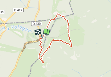

Length
3.3 km

Max alt
1267 m

Uphill gradient
83 m
Km-Effort
4.4 km

Min alt
1205 m

Downhill gradient
84 m
Boucle
Yes
Creation date :
2020-02-05 09:22:08.287
Updated on :
2020-02-08 16:47:44.157
2h19
Difficulty : Medium

FREE GPS app for hiking
 SityTrail
IGN / Geographical institutes
SityTrail Plus
The world is yours!
About
Trail Walking of 3.3 km to be discovered at Grand Est, Vosges, Xonrupt-Longemer. This trail is proposed by gdela.
Positioning
Country:
France
Region :
Grand Est
Department/Province :
Vosges
Municipality :
Xonrupt-Longemer
Location:
Unknown
Start:(Dec)
Start:(UTM)
352105 ; 5323925 (32U) N.
Comments