


monts enbessin

semaine
User

Length
6.7 km

Max alt
215 m

Uphill gradient
124 m
Km-Effort
8.3 km

Min alt
132 m

Downhill gradient
105 m
Boucle
No
Creation date :
2020-02-06 12:59:57.511
Updated on :
2020-02-07 06:15:23.449
1h50
Difficulty : Very easy

FREE GPS app for hiking
 SityTrail
IGN / Geographical institutes
SityTrail Plus
The world is yours!
About
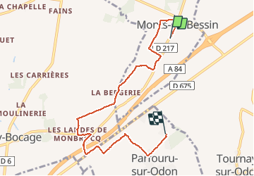
Trail Walking of 6.7 km to be discovered at Normandy, Calvados, Monts-en-Bessin. This trail is proposed by semaine.
Positioning
Country:
France
Region :
Normandy
Department/Province :
Calvados
Municipality :
Monts-en-Bessin
Location:
Unknown
Start:(Dec)
Start:(UTM)
674824 ; 5442662 (30U) N.
Comments