


W_transardennaise 02

JLDECK
User

Length
21 km

Max alt
565 m

Uphill gradient
517 m
Km-Effort
28 km

Min alt
362 m

Downhill gradient
469 m
Boucle
No
Creation date :
2019-02-16 18:54:08.259
Updated on :
2019-02-16 18:54:08.266
5h53
Difficulty : Easy

FREE GPS app for hiking
 SityTrail
IGN / Geographical institutes
SityTrail Plus
The world is yours!
About
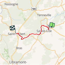
Trail Walking of 21 km to be discovered at Wallonia, Luxembourg, Sainte-Ode. This trail is proposed by JLDECK.
Positioning
Country:
Belgium
Region :
Wallonia
Department/Province :
Luxembourg
Municipality :
Sainte-Ode
Location:
Amberloup
Start:(Dec)
Start:(UTM)
682498 ; 5545857 (31U) N.
Comments