


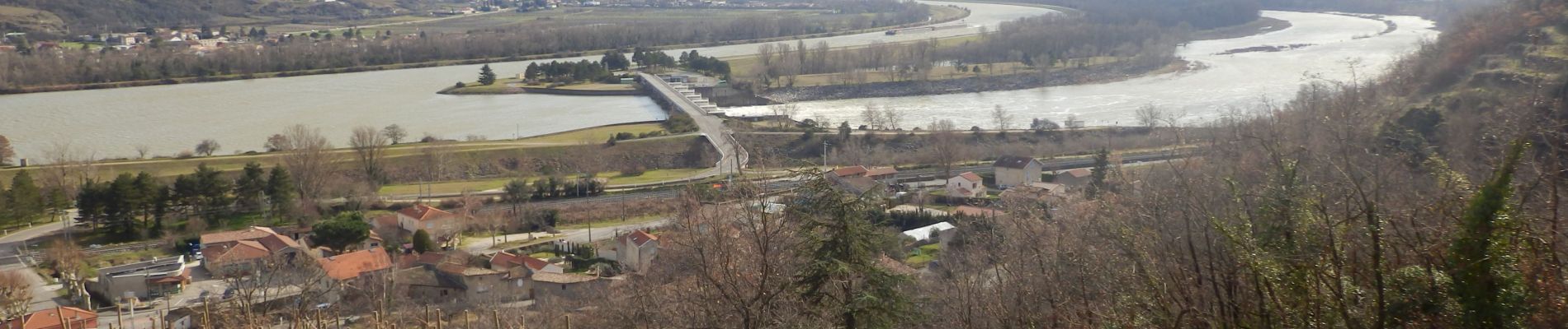
Arras surt Rhône 13 km

thonyc
User GUIDE
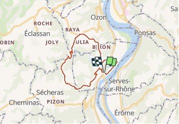

Length
12.8 km

Max alt
405 m

Uphill gradient
444 m
Km-Effort
18.7 km

Min alt
121 m

Downhill gradient
442 m
Boucle
Yes
Creation date :
2020-02-09 08:45:57.844
Updated on :
2020-02-09 16:44:47.848
5h00
Difficulty : Medium

FREE GPS app for hiking
 SityTrail
IGN / Geographical institutes
SityTrail Plus
The world is yours!
About
Trail Walking of 12.8 km to be discovered at Auvergne-Rhône-Alpes, Ardèche, Arras-sur-Rhône. This trail is proposed by thonyc.
Photos


Positioning
Country:
France
Region :
Auvergne-Rhône-Alpes
Department/Province :
Ardèche
Municipality :
Arras-sur-Rhône
Location:
Unknown
Start:(Dec)
Start:(UTM)
642095 ; 5000042 (31T) N.
Comments