


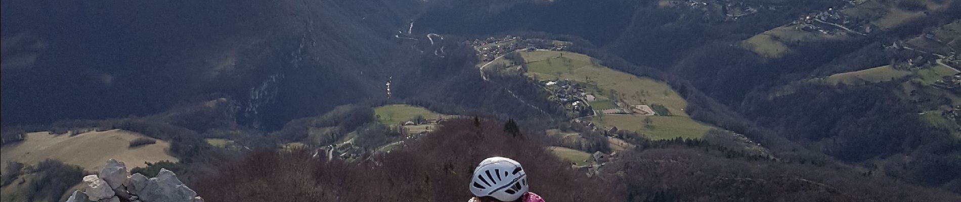
Aiguille de Quaix

crocau
User
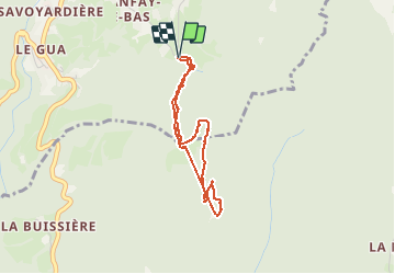

Length
3.2 km

Max alt
1100 m

Uphill gradient
219 m
Km-Effort
6.2 km

Min alt
875 m

Downhill gradient
224 m
Boucle
Yes
Creation date :
2020-02-09 11:19:02.859
Updated on :
2021-04-19 12:38:53.974
1h36
Difficulty : Very easy
1h00
Difficulty : Very easy

FREE GPS app for hiking
 SityTrail
IGN / Geographical institutes
SityTrail Plus
The world is yours!
About
Trail Walking of 3.2 km to be discovered at Auvergne-Rhône-Alpes, Isère, Proveysieux. This trail is proposed by crocau.
Photos


32 photos in total. Please click on a photo to see them all in the gallery.
Positioning
Country:
France
Region :
Auvergne-Rhône-Alpes
Department/Province :
Isère
Municipality :
Proveysieux
Location:
Unknown
Start:(Dec)
Start:(UTM)
713179 ; 5017178 (31T) N.
Comments
chemin très boueux en hiver mais du monde sur le chemin. spectacle hors norme depuis l'aiguille