


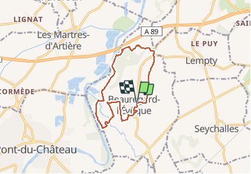
Beauregard l'Evèque la chapelle saint Aventin

jeanic63
User

Length
12.2 km

Max alt
390 m

Uphill gradient
158 m
Km-Effort
14.3 km

Min alt
294 m

Downhill gradient
159 m
Boucle
Yes
Creation date :
2020-02-11 17:08:53.077
Updated on :
2020-02-15 17:55:26.358
--
Difficulty : Easy

FREE GPS app for hiking
 SityTrail
IGN / Geographical institutes
SityTrail Plus
The world is yours!
About
Trail On foot of 12.2 km to be discovered at Auvergne-Rhône-Alpes, Puy-de-Dôme, Beauregard-l'Évêque. This trail is proposed by jeanic63.
Description
départ beauregard l'Evèque parking du stade
Positioning
Country:
France
Region :
Auvergne-Rhône-Alpes
Department/Province :
Puy-de-Dôme
Municipality :
Beauregard-l'Évêque
Location:
Unknown
Start:(Dec)
Start:(UTM)
523243 ; 5073295 (31T) N.
Comments