


col du rousset

guyzinz
User
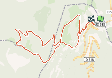

Length
13.9 km

Max alt
1544 m

Uphill gradient
649 m
Km-Effort
23 km

Min alt
1235 m

Downhill gradient
649 m
Boucle
Yes
Creation date :
2020-02-12 08:25:59.731
Updated on :
2020-02-12 14:29:07.894
6h01
Difficulty : Easy

FREE GPS app for hiking
 SityTrail
IGN / Geographical institutes
SityTrail Plus
The world is yours!
About
Trail Walking of 13.9 km to be discovered at Auvergne-Rhône-Alpes, Drôme, Chamaloc. This trail is proposed by guyzinz.
Positioning
Country:
France
Region :
Auvergne-Rhône-Alpes
Department/Province :
Drôme
Municipality :
Chamaloc
Location:
Unknown
Start:(Dec)
Start:(UTM)
689418 ; 4967758 (31T) N.
Comments