


vignelles

lemuid
User
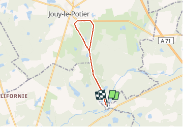

Length
10.3 km

Max alt
122 m

Uphill gradient
62 m
Km-Effort
11.1 km

Min alt
94 m

Downhill gradient
65 m
Boucle
Yes
Creation date :
2020-02-14 08:07:30.991
Updated on :
2020-02-14 10:51:32.367
1h58
Difficulty : Very easy

FREE GPS app for hiking
 SityTrail
IGN / Geographical institutes
SityTrail Plus
The world is yours!
About
Trail Walking of 10.3 km to be discovered at Centre-Loire Valley, Loiret, Jouy-le-Potier. This trail is proposed by lemuid.
Positioning
Country:
France
Region :
Centre-Loire Valley
Department/Province :
Loiret
Municipality :
Jouy-le-Potier
Location:
Unknown
Start:(Dec)
Start:(UTM)
412627 ; 5284122 (31T) N.
Comments