Trail Walking Chaudon-Norante - 
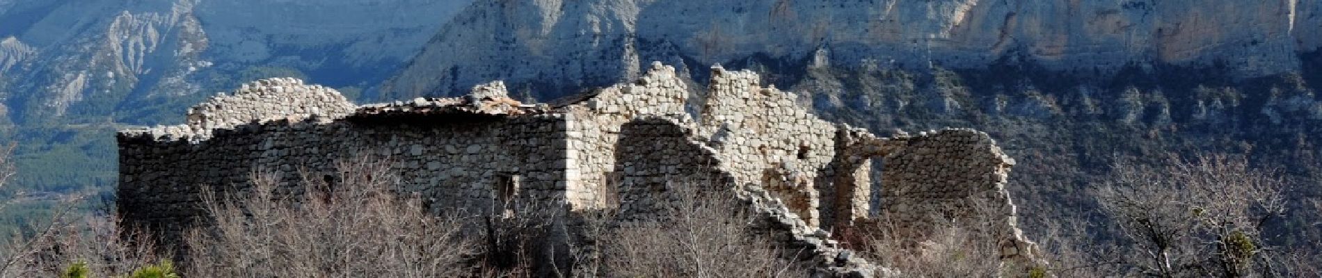
Village abandonné de Creisset - Photo
 domi06
domi06

User

© OpenStreetMap contributors
Length
Length
11.7 km
Max alt
Max alt
1154 m
Uphill gradient
Uphill gradient
572 m
Km-Effort
Km-Effort  
19.4 km
Min alt
Min alt
636 m
Downhill gradient
Downhill gradient
575 m
Boucle
Boucle
Yes
Creation date :
2020-02-16 08:06:31.404
Updated on :
2020-02-18 17:28:44.637

(0 Reviews)

Walking
Walking
4h57
Difficulty : Medium

Scan this QR Code to open this trail in the SityTrail application

FREE GPS app for hiking

Logo SityTrail SityTrail

IGN / Geographical institutes

Download SityTrail from the App Store Download SityTrail from Google Play

Logo SityTrail SityTrail Plus

The world is yours!

Download SityTrail from the App Store Download SityTrail from Google Play Download SityTrail on Huawei AppGallery

About

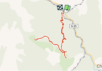
Trail Walking of 11.7 km to be discovered at Provence-Alpes-Côte d'Azur, Alpes-de-Haute-Provence, Chaudon-Norante. This trail is proposed by domi06.

Description

Départ passerelle de Creisset 640m. Petit sentier au milieu d'une jolie forêt menant au village abandonné de Creisset à 3KM : ruines et quelques tombes. Continuation vers la chapelle  St Etienne, point culminant de la randonnée, beau panorama. Retour par le même chemin. Possibilité de grimper jusqu'au ruine du vieux château.

Elevation profile

Photos

Positioning

Country:
France
Region :
Provence-Alpes-Côte d'Azur
Department/Province :
Alpes-de-Haute-Provence
Municipality :
Chaudon-Norante
Location:
Unknown
Start:(UTM)
282363 ; 4875729 (32T) N.


Close
My subscriptions