


BORON

Benteux
User
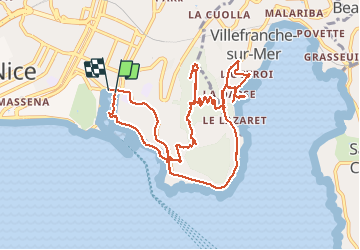

Length
12.7 km

Max alt
223 m

Uphill gradient
367 m
Km-Effort
17.5 km

Min alt
1 m

Downhill gradient
367 m
Boucle
Yes
Creation date :
2020-02-16 08:31:09.682
Updated on :
2020-05-12 13:09:34.135
5h51
Difficulty : Very easy

FREE GPS app for hiking
 SityTrail
IGN / Geographical institutes
SityTrail Plus
The world is yours!
About
Trail Walking of 12.7 km to be discovered at Provence-Alpes-Côte d'Azur, Maritime Alps, Nice. This trail is proposed by Benteux.
Description
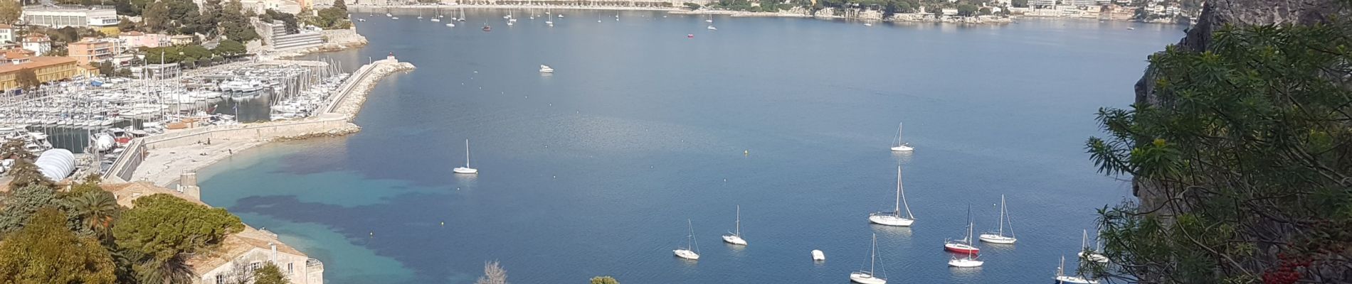
MONT BORON ET VILLEFRANCHE SUR MER marche
Photos


Positioning
Country:
France
Region :
Provence-Alpes-Côte d'Azur
Department/Province :
Maritime Alps
Municipality :
Nice
Location:
Unknown
Start:(Dec)
Start:(UTM)
361905 ; 4839767 (32T) N.
Comments