


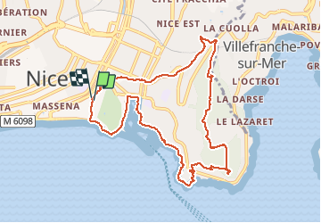
Vieux Nice-Mon Boron

coriace
User

Length
10.7 km

Max alt
223 m

Uphill gradient
302 m
Km-Effort
14.7 km

Min alt
1 m

Downhill gradient
302 m
Boucle
Yes
Creation date :
2020-02-16 11:26:50.429
Updated on :
2020-02-16 15:13:46.943
2h54
Difficulty : Medium

FREE GPS app for hiking
 SityTrail
IGN / Geographical institutes
SityTrail Plus
The world is yours!
About
Trail Walking of 10.7 km to be discovered at Provence-Alpes-Côte d'Azur, Maritime Alps, Nice. This trail is proposed by coriace.
Description
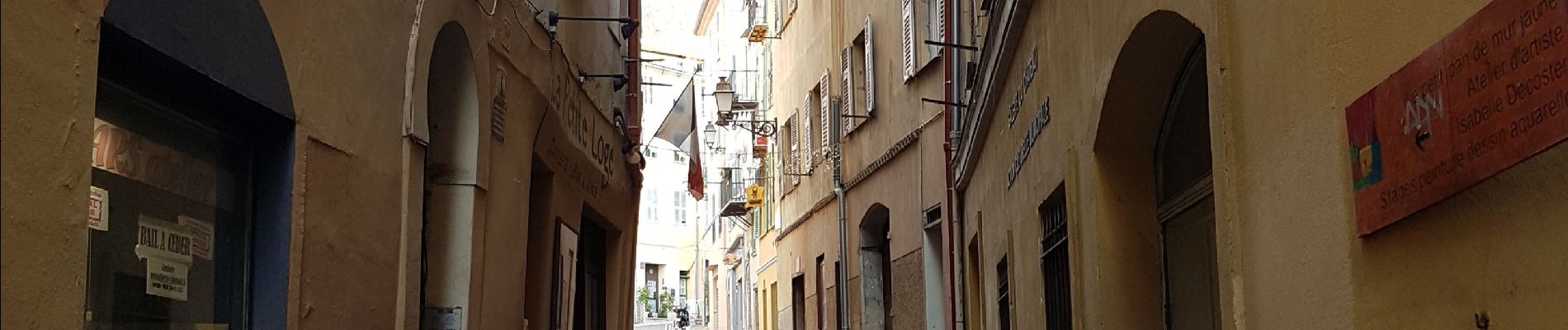
Départ rue Droite dans le vieux Nice passant par le port et le bord de côte via le mont Boron. Retour rue Bonaparte
Photos

Positioning
Country:
France
Region :
Provence-Alpes-Côte d'Azur
Department/Province :
Maritime Alps
Municipality :
Nice
Location:
Unknown
Start:(Dec)
Start:(UTM)
361202 ; 4839744 (32T) N.
Comments