


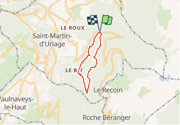
Circuit des Marais- Les Seiglières

crocau
User

Length
9 km

Max alt
1229 m

Uphill gradient
384 m
Km-Effort
14.2 km

Min alt
1008 m

Downhill gradient
383 m
Boucle
Yes
Creation date :
2020-02-16 11:41:14.851
Updated on :
2020-02-24 12:53:58.86
3h23
Difficulty : Very easy

FREE GPS app for hiking
 SityTrail
IGN / Geographical institutes
SityTrail Plus
The world is yours!
About
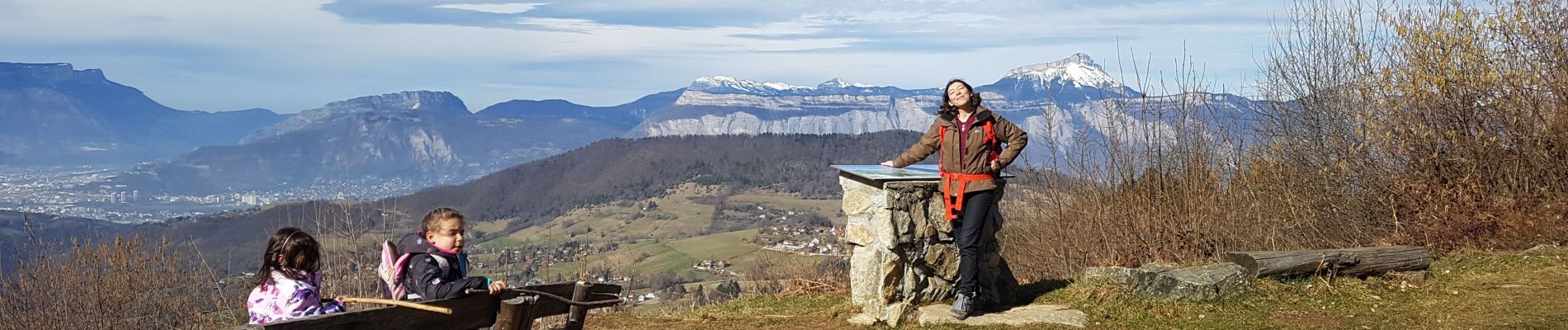
Trail Walking of 9 km to be discovered at Auvergne-Rhône-Alpes, Isère, Saint-Martin-d'Uriage. This trail is proposed by crocau.
Photos


Positioning
Country:
France
Region :
Auvergne-Rhône-Alpes
Department/Province :
Isère
Municipality :
Saint-Martin-d'Uriage
Location:
Unknown
Start:(Dec)
Start:(UTM)
725695 ; 5004148 (31T) N.
Comments