


raquette nelle

trailer38
User
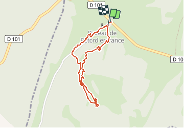

Length
1.9 km

Max alt
1195 m

Uphill gradient
18 m
Km-Effort
2.2 km

Min alt
1175 m

Downhill gradient
18 m
Boucle
Yes
Creation date :
2020-02-17 09:11:50.856
Updated on :
2020-02-17 14:01:27.941
2h12
Difficulty : Very easy

FREE GPS app for hiking
 SityTrail
IGN / Geographical institutes
SityTrail Plus
The world is yours!
About
Trail Walking of 1.9 km to be discovered at Auvergne-Rhône-Alpes, Ain, Valserhône. This trail is proposed by trailer38.
Positioning
Country:
France
Region :
Auvergne-Rhône-Alpes
Department/Province :
Ain
Municipality :
Valserhône
Location:
Châtillon-en-Michaille
Start:(Dec)
Start:(UTM)
710798 ; 5110265 (31T) N.
Comments