


Etangs de Fontargente

petit-pied
User
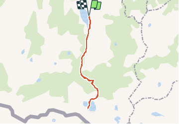

Length
12.8 km

Max alt
2157 m

Uphill gradient
662 m
Km-Effort
22 km

Min alt
1530 m

Downhill gradient
658 m
Boucle
Yes
Creation date :
2020-02-18 23:24:45.814
Updated on :
2020-02-18 23:25:08.962
4h24
Difficulty : Very difficult

FREE GPS app for hiking
 SityTrail
IGN / Geographical institutes
SityTrail Plus
The world is yours!
About
Trail Walking of 12.8 km to be discovered at Occitania, Ariège, Aston. This trail is proposed by petit-pied.
Positioning
Country:
France
Region :
Occitania
Department/Province :
Ariège
Municipality :
Aston
Location:
Unknown
Start:(Dec)
Start:(UTM)
394182 ; 4725312 (31T) N.
Comments