


De saint Ferreol autour du serrât de Salvaterra

robertperello
User
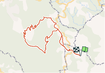

Length
12.4 km

Max alt
424 m

Uphill gradient
404 m
Km-Effort
17.8 km

Min alt
235 m

Downhill gradient
406 m
Boucle
Yes
Creation date :
2020-02-19 08:49:04.0
Updated on :
2020-02-19 14:05:21.702
3h25
Difficulty : Medium

FREE GPS app for hiking
 SityTrail
IGN / Geographical institutes
SityTrail Plus
The world is yours!
About
Trail Walking of 12.4 km to be discovered at Occitania, Pyrénées-Orientales, Céret. This trail is proposed by robertperello.
Description
Facile beau paysage sur le Vallespir
Positioning
Country:
France
Region :
Occitania
Department/Province :
Pyrénées-Orientales
Municipality :
Céret
Location:
Unknown
Start:(Dec)
Start:(UTM)
478823 ; 4707356 (31T) N.
Comments