


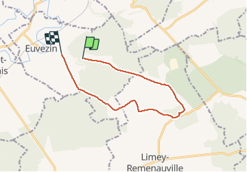
Haut d'Euvezin Chapelle de Remenauville

kikkko
User

Length
10.9 km

Max alt
336 m

Uphill gradient
138 m
Km-Effort
12.7 km

Min alt
260 m

Downhill gradient
135 m
Boucle
No
Creation date :
2020-02-19 13:07:34.093
Updated on :
2020-02-19 16:25:18.645
2h33
Difficulty : Medium

FREE GPS app for hiking
 SityTrail
IGN / Geographical institutes
SityTrail Plus
The world is yours!
About
Trail Walking of 10.9 km to be discovered at Grand Est, Meurthe-et-Moselle, Euvezin. This trail is proposed by kikkko.
Description
Circuit entre forêt et plaine avec découverte du village détruit de Remenauville
Positioning
Country:
France
Region :
Grand Est
Department/Province :
Meurthe-et-Moselle
Municipality :
Euvezin
Location:
Unknown
Start:(Dec)
Start:(UTM)
709460 ; 5422596 (31U) N.
Comments