


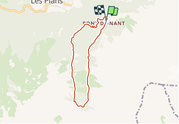

16.8 km | 30 km-effort


User


FREE GPS app for hiking
 SityTrail
IGN / Geographical institutes
SityTrail World
The world is yours!
Trail Other activity of 6.2 km to be discovered at Vaud, District d'Aigle, Bex. This trail is proposed by avrouge.
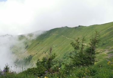
Randonnée vertigineuse dans la magnifique région du Vallon de Nant au pied des Muverans.
Walking

Walking
Walking

Mountain bike

Running
Running
Walking
Walking
Walking