


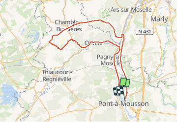
Route

PhilippeC54
User

Length
63 km

Max alt
308 m

Uphill gradient
527 m
Km-Effort
70 km

Min alt
164 m

Downhill gradient
523 m
Boucle
No
Creation date :
2020-03-01 07:53:27.755
Updated on :
2020-03-01 10:43:59.485
2h34
Difficulty : Very easy

FREE GPS app for hiking
 SityTrail
IGN / Geographical institutes
SityTrail Plus
The world is yours!
About
Trail Road bike of 63 km to be discovered at Grand Est, Meurthe-et-Moselle, Pont-à-Mousson. This trail is proposed by PhilippeC54.
Positioning
Country:
France
Region :
Grand Est
Department/Province :
Meurthe-et-Moselle
Municipality :
Pont-à-Mousson
Location:
Unknown
Start:(Dec)
Start:(UTM)
283181 ; 5422956 (32U) N.
Comments