


plaine gueschart

Martelpierre
User

Length
2.2 km

Max alt
103 m

Uphill gradient
11 m
Km-Effort
2.3 km

Min alt
92 m

Downhill gradient
9 m
Boucle
No
Creation date :
2020-03-01 10:32:44.709
Updated on :
2020-03-01 11:05:53.05
27m
Difficulty : Very easy

FREE GPS app for hiking
 SityTrail
IGN / Geographical institutes
SityTrail Plus
The world is yours!
About
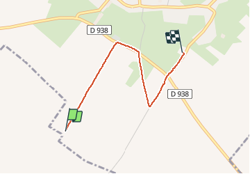
Trail Walking of 2.2 km to be discovered at Hauts-de-France, Somme, Gueschart. This trail is proposed by Martelpierre.
Positioning
Country:
France
Region :
Hauts-de-France
Department/Province :
Somme
Municipality :
Gueschart
Location:
Unknown
Start:(Dec)
Start:(UTM)
428833 ; 5564415 (31U) N.
Comments