


Randonnée Naintre

Arnaud Dejean
User
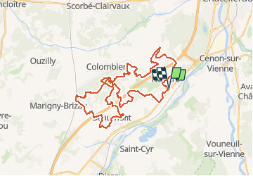

Length
42 km

Max alt
157 m

Uphill gradient
538 m
Km-Effort
49 km

Min alt
60 m

Downhill gradient
537 m
Boucle
Yes
Creation date :
2020-03-08 07:00:57.181
Updated on :
2020-03-08 11:07:06.42
3h08
Difficulty : Medium

FREE GPS app for hiking
 SityTrail
IGN / Geographical institutes
SityTrail Plus
The world is yours!
About
Trail Mountain bike of 42 km to be discovered at New Aquitaine, Vienne, Naintré. This trail is proposed by Arnaud Dejean.
Positioning
Country:
France
Region :
New Aquitaine
Department/Province :
Vienne
Municipality :
Naintré
Location:
Unknown
Start:(Dec)
Start:(UTM)
307972 ; 5181190 (31T) N.
Comments