


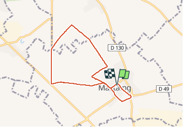
rando de l'empereur 7 kms. mastaing

papiou
User


1h37
Difficulty : Easy

FREE GPS app for hiking
 SityTrail
IGN / Geographical institutes
SityTrail Plus
The world is yours!
About
Trail Walking of 6.9 km to be discovered at Hauts-de-France, Nord, Mastaing. This trail is proposed by papiou.
Description
rdv salle des fêtes et face à elle partir vers la droite jusqu'à l'église, prendre à droite, en haut des pavés à droite puis 1 ère à gauche et au bout à gauche, sur le CD à gauche et peu avant carrefour prendre à gauche petite route pour rejoindre village puis faire le tour de celui-ci.
Positioning
Comments