


Meysse 6km

thonyc
User GUIDE
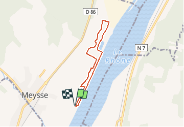

Length
5.9 km

Max alt
86 m

Uphill gradient
50 m
Km-Effort
6.5 km

Min alt
72 m

Downhill gradient
51 m
Boucle
Yes
Creation date :
2020-03-10 16:04:21.062
Updated on :
2020-03-10 22:22:33.054
1h41
Difficulty : Easy

FREE GPS app for hiking
 SityTrail
IGN / Geographical institutes
SityTrail Plus
The world is yours!
About
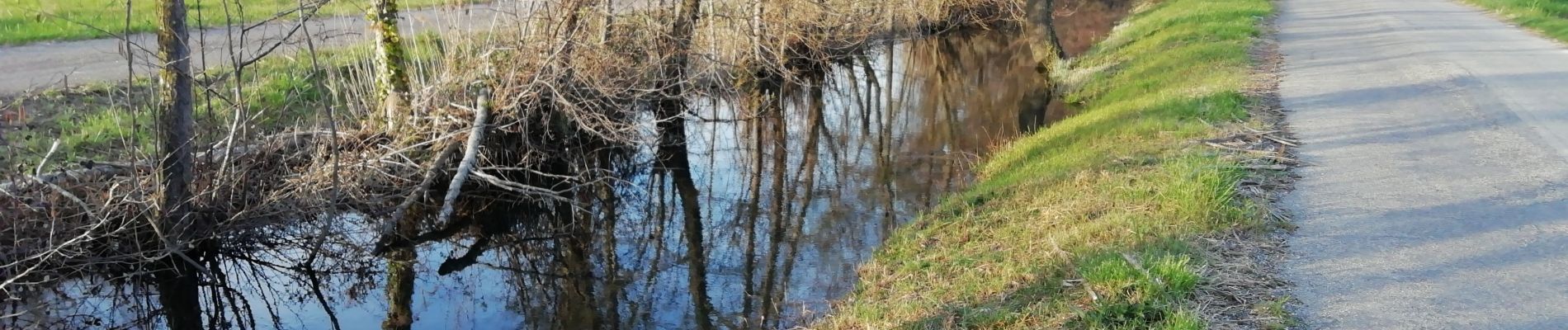
Trail Walking of 5.9 km to be discovered at Auvergne-Rhône-Alpes, Ardèche, Meysse. This trail is proposed by thonyc.
Photos


Positioning
Country:
France
Region :
Auvergne-Rhône-Alpes
Department/Province :
Ardèche
Municipality :
Meysse
Location:
Unknown
Start:(Dec)
Start:(UTM)
637910 ; 4940728 (31T) N.
Comments