


54 T.M.F Esterel
Aridomi
Sur les chemins tout va bien
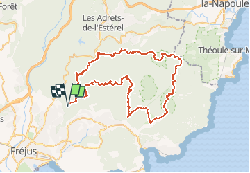

Length
43 km

Max alt
600 m

Uphill gradient
1404 m
Km-Effort
61 km

Min alt
15 m

Downhill gradient
1404 m
Boucle
Yes
Creation date :
2020-03-13 03:20:28.635
Updated on :
2020-03-15 07:55:13.055
12h51
Difficulty : Very difficult

FREE GPS app for hiking
 SityTrail
IGN / Geographical institutes
SityTrail Plus
The world is yours!
About
Trail Walking of 43 km to be discovered at Provence-Alpes-Côte d'Azur, Var, Fréjus. This trail is proposed by Aridomi.
Description
Nouvelle version. Car le sentier le long du ravin des 3 Termes est très abimé (seulement 1km et 20m de dénivelé en plus)
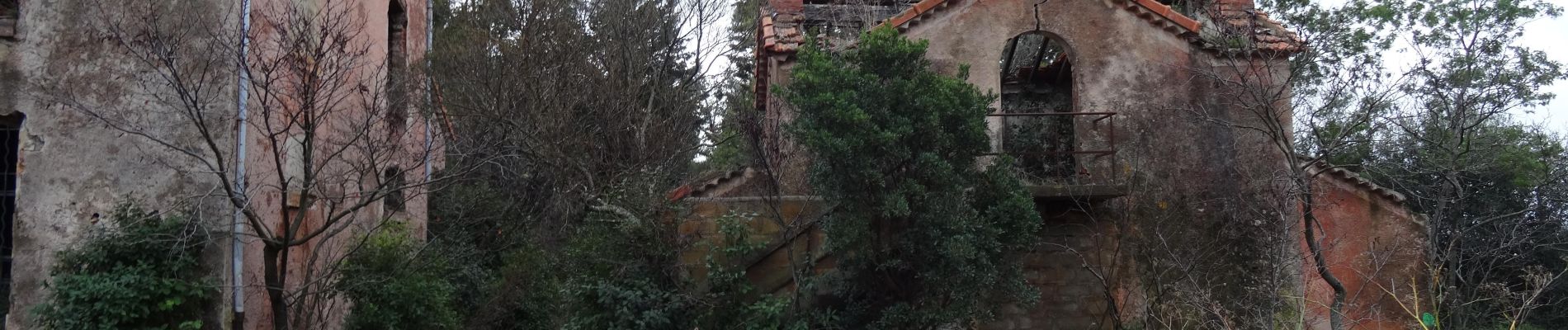
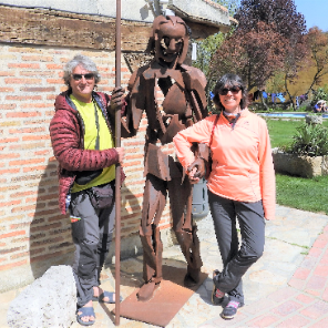
Photos


Positioning
Country:
France
Region :
Provence-Alpes-Côte d'Azur
Department/Province :
Var
Municipality :
Fréjus
Location:
Unknown
Start:(Dec)
Start:(UTM)
320477 ; 4814920 (32T) N.
Comments