


Bruno 8122013

maginot
User
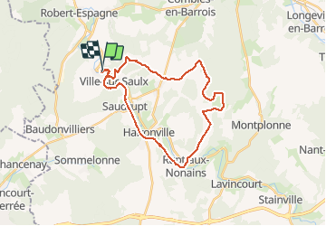

Length
27 km

Max alt
280 m

Uphill gradient
343 m
Km-Effort
32 km

Min alt
167 m

Downhill gradient
344 m
Boucle
Yes
Creation date :
2014-12-10 00:00:00.0
Updated on :
2014-12-10 00:00:00.0
1h59
Difficulty : Easy

FREE GPS app for hiking
 SityTrail
IGN / Geographical institutes
SityTrail Plus
The world is yours!
About
Trail Walking of 27 km to be discovered at Grand Est, Meuse, L'Isle-en-Rigault. This trail is proposed by maginot.
Description
Temps doux /parcours connu mais très sympa surtout le long de la forêt du haut jure vers brillon
Positioning
Country:
France
Region :
Grand Est
Department/Province :
Meuse
Municipality :
L'Isle-en-Rigault
Location:
Unknown
Start:(Dec)
Start:(UTM)
650753 ; 5397969 (31U) N.
Comments