


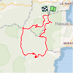
Boucle autour du Pic de l'Ours

PEBREJOSIANE
User

Length
19.9 km

Max alt
437 m

Uphill gradient
869 m
Km-Effort
31 km

Min alt
51 m

Downhill gradient
871 m
Boucle
Yes
Creation date :
2014-12-10 00:00:00.0
Updated on :
2014-12-10 00:00:00.0
5h59
Difficulty : Medium

FREE GPS app for hiking
 SityTrail
IGN / Geographical institutes
SityTrail Plus
The world is yours!
About
Trail Walking of 19.9 km to be discovered at Provence-Alpes-Côte d'Azur, Maritime Alps, Mandelieu-la-Napoule. This trail is proposed by PEBREJOSIANE.
Description
rando en terrrain varié avec de trés belles vues sur le littoral, petite grotte à visiter à l'aplomb du pic de l'Ours
Positioning
Country:
France
Region :
Provence-Alpes-Côte d'Azur
Department/Province :
Maritime Alps
Municipality :
Mandelieu-la-Napoule
Location:
Unknown
Start:(Dec)
Start:(UTM)
331537 ; 4819971 (32T) N.
Comments