


ibon-de-plan-03-08-17

jacq58
User
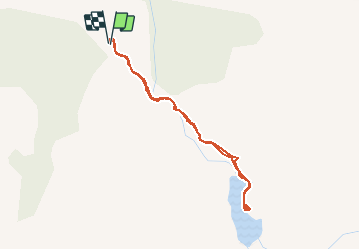

Length
4.7 km

Max alt
1924 m

Uphill gradient
108 m
Km-Effort
6.1 km

Min alt
1871 m

Downhill gradient
108 m
Boucle
Yes
Creation date :
2020-03-16 10:58:29.35
Updated on :
2020-03-16 10:58:29.35

FREE GPS app for hiking
 SityTrail
IGN / Geographical institutes
SityTrail Plus
The world is yours!
About
Trail of 4.7 km to be discovered at Aragon, Huesca, Plan. This trail is proposed by jacq58.
Positioning
Country:
Spain
Region :
Aragon
Department/Province :
Huesca
Municipality :
Plan
Location:
Unknown
Start:(Dec)
Start:(UTM)
279538 ; 4714983 (31T) N.
Comments