


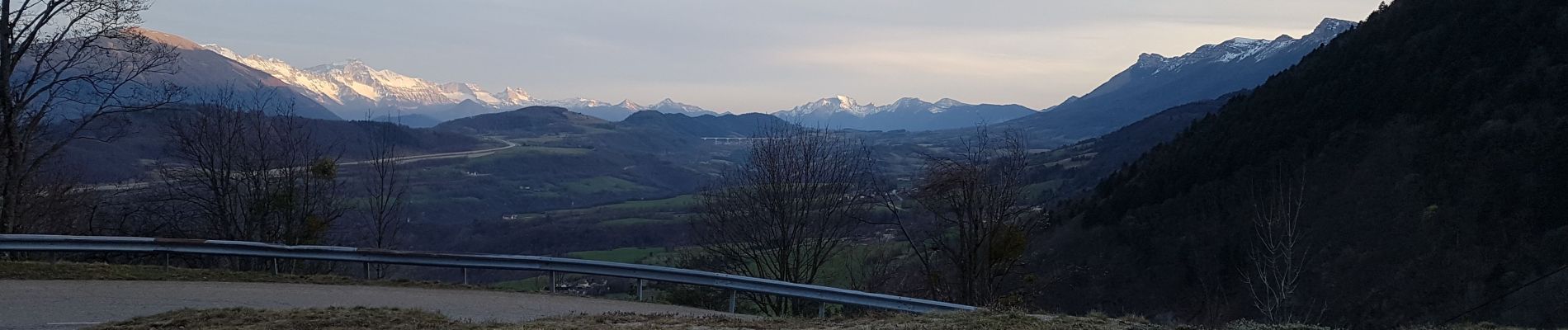
Le Col de L'Arzelier vers Saint Andéol

crocau
User
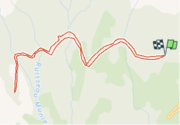

Length
6.5 km

Max alt
1293 m

Uphill gradient
124 m
Km-Effort
8.1 km

Min alt
1222 m

Downhill gradient
125 m
Boucle
Yes
Creation date :
2020-03-16 22:37:28.674
Updated on :
2020-03-16 22:42:25.735
1h45
Difficulty : Medium

FREE GPS app for hiking
 SityTrail
IGN / Geographical institutes
SityTrail Plus
The world is yours!
About
Trail Walking of 6.5 km to be discovered at Auvergne-Rhône-Alpes, Isère, Château-Bernard. This trail is proposed by crocau.
Description
Une route forestière plate qui longe les falaises depuis les 2 Soeurs. On voit le Mont Aiguille, le Sénépi, l'Obiou...A refaire en vtt
Photos

Positioning
Country:
France
Region :
Auvergne-Rhône-Alpes
Department/Province :
Isère
Municipality :
Château-Bernard
Location:
Unknown
Start:(Dec)
Start:(UTM)
703415 ; 4984844 (31T) N.
Comments