


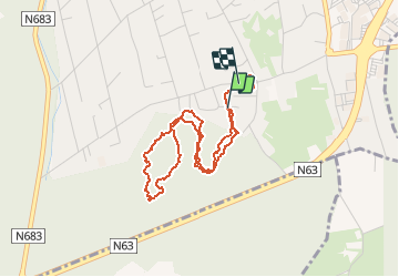
Balade de Maximus

henriantoine
User

Length
3.8 km

Max alt
283 m

Uphill gradient
42 m
Km-Effort
4.3 km

Min alt
256 m

Downhill gradient
43 m
Boucle
Yes
Creation date :
2020-03-22 13:17:52.0
Updated on :
2020-03-22 14:30:47.32
1h12
Difficulty : Easy

FREE GPS app for hiking
 SityTrail
IGN / Geographical institutes
SityTrail Plus
The world is yours!
About
Trail Walking of 3.8 km to be discovered at Wallonia, Liège, Seraing. This trail is proposed by henriantoine.
Photos


Positioning
Country:
Belgium
Region :
Wallonia
Department/Province :
Liège
Municipality :
Seraing
Location:
Boncelles
Start:(Dec)
Start:(UTM)
679807 ; 5604389 (31U) N.
Comments