


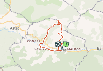
Mayres Chaumiène

thonyc
User GUIDE

Length
11.7 km

Max alt
1346 m

Uphill gradient
807 m
Km-Effort
22 km

Min alt
571 m

Downhill gradient
807 m
Boucle
Yes
Creation date :
2020-03-29 09:16:21.274
Updated on :
2020-03-29 09:18:41.959
4h29
Difficulty : Difficult

FREE GPS app for hiking
 SityTrail
IGN / Geographical institutes
SityTrail Plus
The world is yours!
About
Trail Walking of 11.7 km to be discovered at Auvergne-Rhône-Alpes, Ardèche, Mayres. This trail is proposed by thonyc.
Positioning
Country:
France
Region :
Auvergne-Rhône-Alpes
Department/Province :
Ardèche
Municipality :
Mayres
Location:
Unknown
Start:(Dec)
Start:(UTM)
588495 ; 4946400 (31T) N.
Comments