


Tour sommet V2

Spinnaker
User
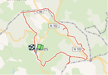

Length
11.7 km

Max alt
1309 m

Uphill gradient
311 m
Km-Effort
15.9 km

Min alt
1111 m

Downhill gradient
320 m
Boucle
Yes
Creation date :
2020-04-04 08:29:43.938
Updated on :
2020-04-04 10:52:01.28
2h20
Difficulty : Medium

FREE GPS app for hiking
 SityTrail
IGN / Geographical institutes
SityTrail Plus
The world is yours!
About
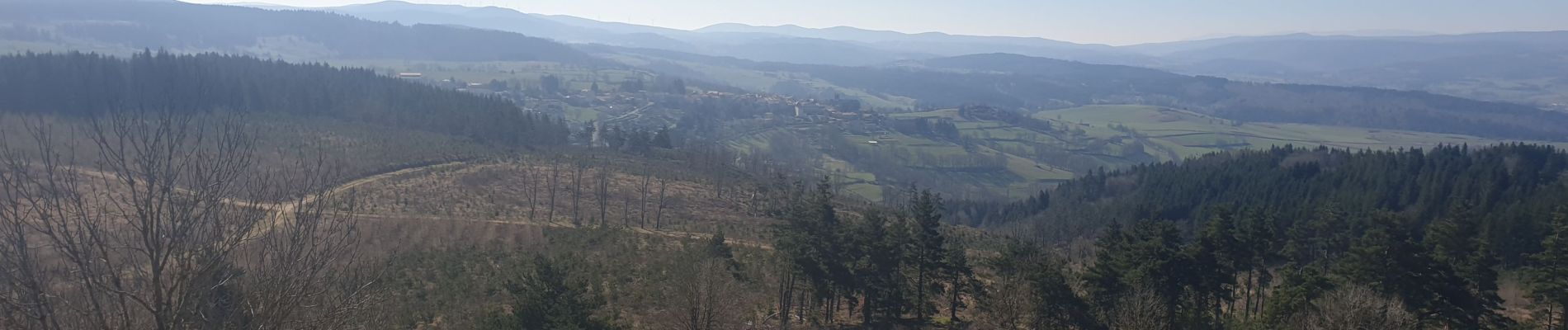
Trail Walking of 11.7 km to be discovered at Auvergne-Rhône-Alpes, Haute-Loire, Pradelles. This trail is proposed by Spinnaker.
Photos


Positioning
Country:
France
Region :
Auvergne-Rhône-Alpes
Department/Province :
Haute-Loire
Municipality :
Pradelles
Location:
Unknown
Start:(Dec)
Start:(UTM)
569835 ; 4957589 (31T) N.
Comments