


SityTrail - Gorges Verdon

ramagufa
User
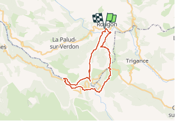

Length
30 km

Max alt
1156 m

Uphill gradient
1971 m
Km-Effort
56 km

Min alt
556 m

Downhill gradient
1971 m
Boucle
Yes
Creation date :
2020-04-08 17:57:58.838
Updated on :
2020-04-22 19:00:57.535
11h56
Difficulty : Very difficult

FREE GPS app for hiking
 SityTrail
IGN / Geographical institutes
SityTrail Plus
The world is yours!
About
Trail Walking of 30 km to be discovered at Provence-Alpes-Côte d'Azur, Alpes-de-Haute-Provence, Rougon. This trail is proposed by ramagufa.
Description
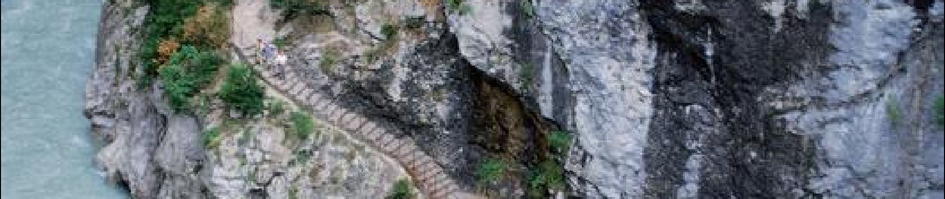
Sentier Blanc Martel
Départ du point Sublîme.
Logement possible à l'auberges des cavaliers ou à l'auberge du point Sublime.
Photos

Positioning
Country:
France
Region :
Provence-Alpes-Côte d'Azur
Department/Province :
Alpes-de-Haute-Provence
Municipality :
Rougon
Location:
Unknown
Start:(Dec)
Start:(UTM)
290714 ; 4852297 (32T) N.
Comments