


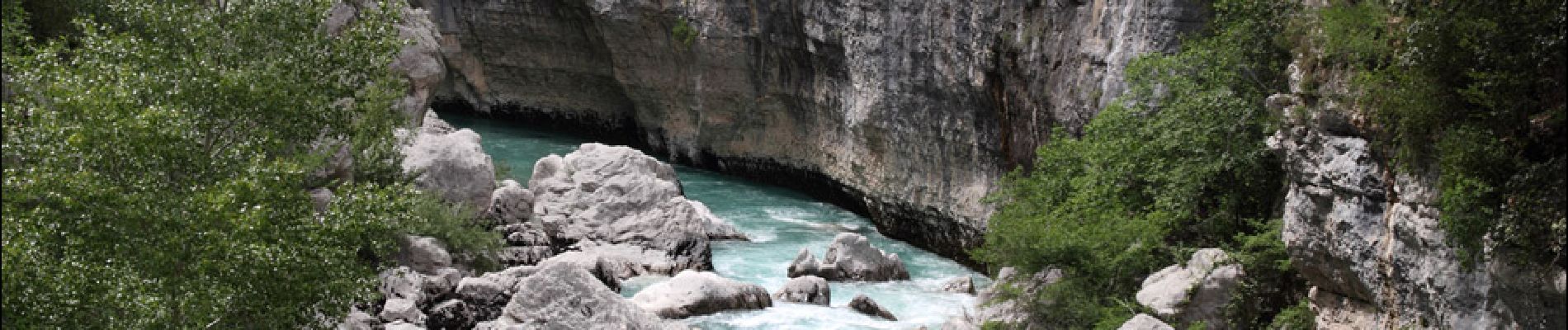
SityTrail - LES GORGES DU VERDON Le Sentier de l'Imbut - 7.2KM +880

ramagufa
User

Length
8.8 km

Max alt
949 m

Uphill gradient
768 m
Km-Effort
19.1 km

Min alt
538 m

Downhill gradient
768 m
Boucle
Yes
Creation date :
2020-04-09 08:16:55.174
Updated on :
2020-04-13 18:04:15.605
3h30
Difficulty : Very difficult

FREE GPS app for hiking
 SityTrail
IGN / Geographical institutes
SityTrail Plus
The world is yours!
About
Trail Walking of 8.8 km to be discovered at Provence-Alpes-Côte d'Azur, Var, Aiguines. This trail is proposed by ramagufa.
Description
Le tour du Verdon
Le sentier Vidal ne peut se faire qu'à la montée. Très hard
A faire au moins une fois.
https://www.leblogcashpistache.fr/gorges-du-verdon-la-plus-belle-randonnee-imbut/
Photos

Positioning
Country:
France
Region :
Provence-Alpes-Côte d'Azur
Department/Province :
Var
Municipality :
Aiguines
Location:
Unknown
Start:(Dec)
Start:(UTM)
286220 ; 4846181 (32T) N.
Comments