


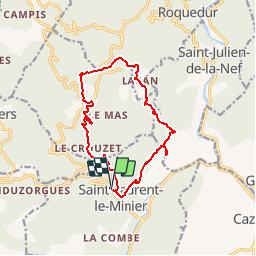
boucle de saint laurent le minier

pipette12
User

Length
14 km

Max alt
714 m

Uphill gradient
689 m
Km-Effort
23 km

Min alt
180 m

Downhill gradient
692 m
Boucle
Yes
Creation date :
2014-12-10 00:00:00.0
Updated on :
2014-12-10 00:00:00.0
--
Difficulty : Medium

FREE GPS app for hiking
 SityTrail
IGN / Geographical institutes
SityTrail Plus
The world is yours!
About
Trail Walking of 14 km to be discovered at Occitania, Gard, Saint-Laurent-le-Minier. This trail is proposed by pipette12.
Description
saint laurent le minier


Positioning
Country:
France
Region :
Occitania
Department/Province :
Gard
Municipality :
Saint-Laurent-le-Minier
Location:
Unknown
Start:(Dec)
Start:(UTM)
552390 ; 4864645 (31T) N.
Comments