


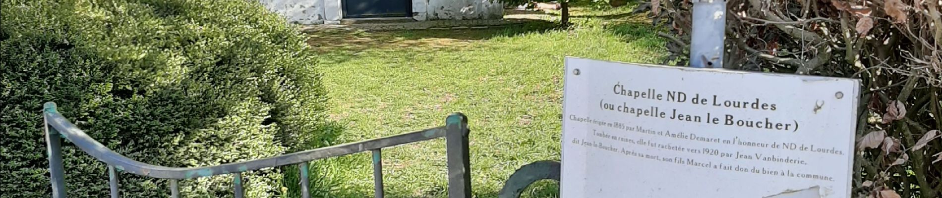
Marcha / Jean le Boucher / vers Luttre / Eglise Obaix / Moulin / Gare

mvrydagh
User

Length
6.8 km

Max alt
155 m

Uphill gradient
53 m
Km-Effort
7.5 km

Min alt
128 m

Downhill gradient
53 m
Boucle
Yes
Creation date :
2020-04-13 14:59:32.114
Updated on :
2020-04-13 16:33:41.359
1h33
Difficulty : Very easy

FREE GPS app for hiking
 SityTrail
IGN / Geographical institutes
SityTrail Plus
The world is yours!
About
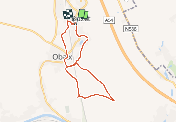
Trail Walking of 6.8 km to be discovered at Wallonia, Hainaut, Pont-à-Celles. This trail is proposed by mvrydagh.
Description
Marcha / Jean le Boucher / vers Luttre / Eglise Obaix / Moulin / Gare
Photos


Positioning
Country:
Belgium
Region :
Wallonia
Department/Province :
Hainaut
Municipality :
Pont-à-Celles
Location:
Buzet
Start:(Dec)
Start:(UTM)
596837 ; 5599006 (31U) N.
Comments