


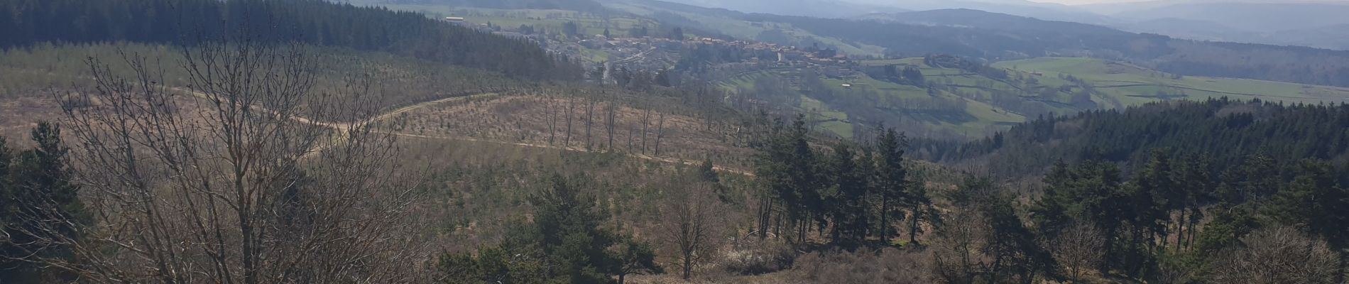
Marche rapide Pradelles

Spinnaker
User
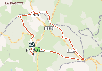

Length
9.8 km

Max alt
1304 m

Uphill gradient
279 m
Km-Effort
13.4 km

Min alt
1125 m

Downhill gradient
266 m
Boucle
No
Creation date :
2020-04-15 08:35:16.087
Updated on :
2020-04-15 10:46:58.918
1h44
Difficulty : Easy

FREE GPS app for hiking
 SityTrail
IGN / Geographical institutes
SityTrail Plus
The world is yours!
About
Trail Walking of 9.8 km to be discovered at Auvergne-Rhône-Alpes, Haute-Loire, Pradelles. This trail is proposed by Spinnaker.
Photos


Positioning
Country:
France
Region :
Auvergne-Rhône-Alpes
Department/Province :
Haute-Loire
Municipality :
Pradelles
Location:
Unknown
Start:(Dec)
Start:(UTM)
569853 ; 4957557 (31T) N.
Comments