


Frontières2020_10

fra_depoorter
User
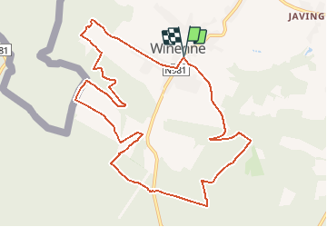

Length
11 km

Max alt
356 m

Uphill gradient
254 m
Km-Effort
14.4 km

Min alt
223 m

Downhill gradient
253 m
Boucle
Yes
Creation date :
2019-05-07 01:39:49.938
Updated on :
2020-04-27 07:02:14.857
3h04
Difficulty : Easy

FREE GPS app for hiking
 SityTrail
IGN / Geographical institutes
SityTrail Plus
The world is yours!
About
Trail Walking of 11 km to be discovered at Wallonia, Namur, Beauraing. This trail is proposed by fra_depoorter.
Description
Marche FFBMP au départ de Winenne les 4 et 5 juillet 2020
Positioning
Country:
Belgium
Region :
Wallonia
Department/Province :
Namur
Municipality :
Beauraing
Location:
Winenne
Start:(Dec)
Start:(UTM)
635480 ; 5551133 (31U) N.
Comments