


Col de Cou

bffcuc
User
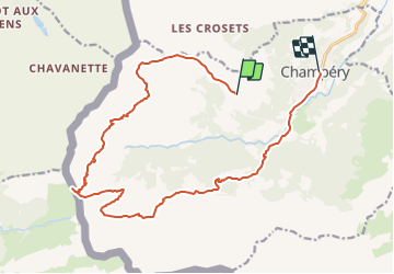

Length
18.1 km

Max alt
1930 m

Uphill gradient
416 m
Km-Effort
26 km

Min alt
1017 m

Downhill gradient
1172 m
Boucle
No
Creation date :
2014-12-11 00:00:00.0
Updated on :
2014-12-11 00:00:00.0
5h56
Difficulty : Unknown

FREE GPS app for hiking
 SityTrail
IGN / Geographical institutes
SityTrail Plus
The world is yours!
About
Trail Other activity of 18.1 km to be discovered at Valais/Wallis, Monthey, Champéry. This trail is proposed by bffcuc.
Positioning
Country:
Switzerland
Region :
Valais/Wallis
Department/Province :
Monthey
Municipality :
Champéry
Location:
Unknown
Start:(Dec)
Start:(UTM)
333600 ; 5115279 (32T) N.
Comments