


10 GTMC Nant-Dio et Valquières

nicolas54230
User
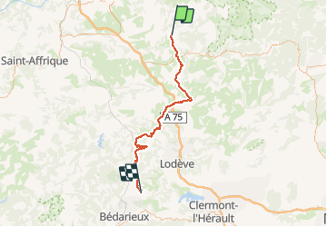

Length
74 km

Max alt
859 m

Uphill gradient
1687 m
Km-Effort
97 km

Min alt
276 m

Downhill gradient
1775 m
Boucle
No
Creation date :
2020-04-29 13:30:53.572
Updated on :
2020-04-29 16:15:15.043
12m
Difficulty : Easy

FREE GPS app for hiking
 SityTrail
IGN / Geographical institutes
SityTrail Plus
The world is yours!
About
Trail Mountain bike of 74 km to be discovered at Occitania, Aveyron, Nant. This trail is proposed by nicolas54230.
Positioning
Country:
France
Region :
Occitania
Department/Province :
Aveyron
Municipality :
Nant
Location:
Unknown
Start:(Dec)
Start:(UTM)
524440 ; 4873397 (31T) N.
Comments