


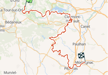
11 GTMC Dio-Montagnac

nicolas54230
User

Length
96 km

Max alt
471 m

Uphill gradient
1724 m
Km-Effort
121 km

Min alt
12 m

Downhill gradient
2081 m
Boucle
No
Creation date :
2020-04-29 16:17:28.207
Updated on :
2020-05-03 21:15:00.442
14m
Difficulty : Easy

FREE GPS app for hiking
 SityTrail
IGN / Geographical institutes
SityTrail Plus
The world is yours!
About
Trail Mountain bike of 96 km to be discovered at Occitania, Hérault, Dio-et-Valquières. This trail is proposed by nicolas54230.
Positioning
Country:
France
Region :
Occitania
Department/Province :
Hérault
Municipality :
Dio-et-Valquières
Location:
Unknown
Start:(Dec)
Start:(UTM)
517237 ; 4834940 (31T) N.
Comments