


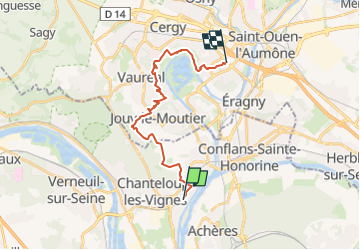
D'Andrésy à Cergy Pontoise

jpcccb
User

Length
18.1 km

Max alt
135 m

Uphill gradient
314 m
Km-Effort
22 km

Min alt
20 m

Downhill gradient
321 m
Boucle
No
Creation date :
2020-05-02 15:25:34.2
Updated on :
2023-04-27 13:16:01.065
5h04
Difficulty : Medium

FREE GPS app for hiking
 SityTrail
IGN / Geographical institutes
SityTrail Plus
The world is yours!
About
Trail On foot of 18.1 km to be discovered at Ile-de-France, Yvelines, Andrésy. This trail is proposed by jpcccb.
Positioning
Country:
France
Region :
Ile-de-France
Department/Province :
Yvelines
Municipality :
Andrésy
Location:
Unknown
Start:(Dec)
Start:(UTM)
430452 ; 5425087 (31U) N.
Comments