


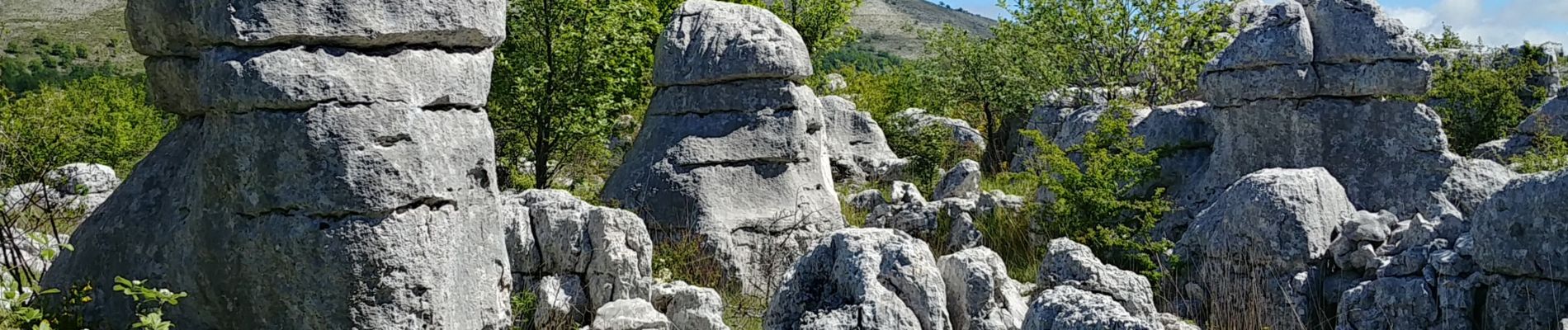
puy tourettes

fab4u
User
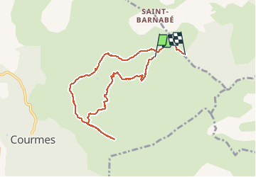

Length
8.8 km

Max alt
1256 m

Uphill gradient
354 m
Km-Effort
13.5 km

Min alt
937 m

Downhill gradient
336 m
Boucle
No
Creation date :
2020-05-12 09:13:51.585
Updated on :
2020-05-14 05:34:46.084
4h05
Difficulty : Very easy

FREE GPS app for hiking
 SityTrail
IGN / Geographical institutes
SityTrail Plus
The world is yours!
About
Trail Walking of 8.8 km to be discovered at Provence-Alpes-Côte d'Azur, Maritime Alps, Courmes. This trail is proposed by fab4u.
Photos


Positioning
Country:
France
Region :
Provence-Alpes-Côte d'Azur
Department/Province :
Maritime Alps
Municipality :
Courmes
Location:
Unknown
Start:(Dec)
Start:(UTM)
342089 ; 4846761 (32T) N.
Comments