


la brasque

Coryphene
User
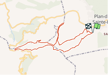

Length
11 km

Max alt
914 m

Uphill gradient
555 m
Km-Effort
18.4 km

Min alt
679 m

Downhill gradient
556 m
Boucle
Yes
Creation date :
2020-05-16 08:24:37.327
Updated on :
2020-05-16 08:25:48.12
--
Difficulty : Very easy

FREE GPS app for hiking
 SityTrail
IGN / Geographical institutes
SityTrail Plus
The world is yours!
About
Trail On foot of 11 km to be discovered at Provence-Alpes-Côte d'Azur, Var, Plan-d'Aups-Sainte-Baume. This trail is proposed by Coryphene.
Description
randonnée de reco de Christian
Positioning
Country:
France
Region :
Provence-Alpes-Côte d'Azur
Department/Province :
Var
Municipality :
Plan-d'Aups-Sainte-Baume
Location:
Unknown
Start:(Dec)
Start:(UTM)
719446 ; 4800303 (31T) N.
Comments