


Champagne Tour du Laye

avdem
User
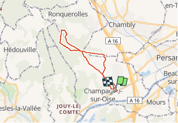

Length
11.7 km

Max alt
173 m

Uphill gradient
179 m
Km-Effort
14.1 km

Min alt
22 m

Downhill gradient
178 m
Boucle
Yes
Creation date :
2020-05-19 07:14:42.624
Updated on :
2020-05-19 09:59:05.475
2h43
Difficulty : Very easy

FREE GPS app for hiking
 SityTrail
IGN / Geographical institutes
SityTrail Plus
The world is yours!
About
Trail Walking of 11.7 km to be discovered at Ile-de-France, Val-d'Oise, Champagne-sur-Oise. This trail is proposed by avdem.
Description
Tres bien a l hombre
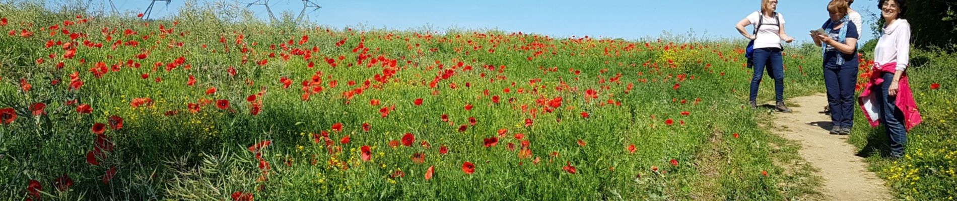
Photos

Positioning
Country:
France
Region :
Ile-de-France
Department/Province :
Val-d'Oise
Municipality :
Champagne-sur-Oise
Location:
Unknown
Start:(Dec)
Start:(UTM)
444553 ; 5442765 (31U) N.
Comments