


Pique d'Endron

petit-pied
User
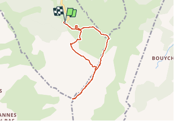

Length
7.9 km

Max alt
2459 m

Uphill gradient
974 m
Km-Effort
21 km

Min alt
1474 m

Downhill gradient
992 m
Boucle
Yes
Creation date :
2020-05-19 09:02:49.827
Updated on :
2020-05-19 14:32:25.307
2h46
Difficulty : Medium

FREE GPS app for hiking
 SityTrail
IGN / Geographical institutes
SityTrail Plus
The world is yours!
About
Trail Trail of 7.9 km to be discovered at Occitania, Ariège, Val-de-Sos. This trail is proposed by petit-pied.
Positioning
Country:
France
Region :
Occitania
Department/Province :
Ariège
Municipality :
Val-de-Sos
Location:
Goulier
Start:(Dec)
Start:(UTM)
378365 ; 4732934 (31T) N.
Comments