


VAUVERT 200519

Dupuybadonniere
User
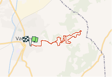

Length
8.2 km

Max alt
89 m

Uphill gradient
147 m
Km-Effort
10.2 km

Min alt
46 m

Downhill gradient
148 m
Boucle
Yes
Creation date :
2020-05-19 15:19:24.939
Updated on :
2020-05-19 17:35:19.048
2h14
Difficulty : Very easy

FREE GPS app for hiking
 SityTrail
IGN / Geographical institutes
SityTrail Plus
The world is yours!
About
Trail Walking of 8.2 km to be discovered at Occitania, Gard, Vauvert. This trail is proposed by Dupuybadonniere.
Positioning
Country:
France
Region :
Occitania
Department/Province :
Gard
Municipality :
Vauvert
Location:
Unknown
Start:(Dec)
Start:(UTM)
603043 ; 4838147 (31T) N.
Comments