


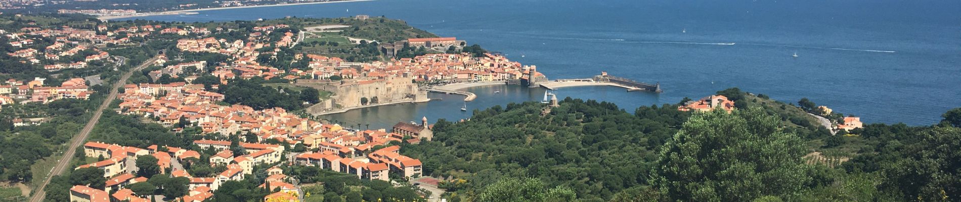
Port vendres - Collioure par la route des crêtes

robertperello
User
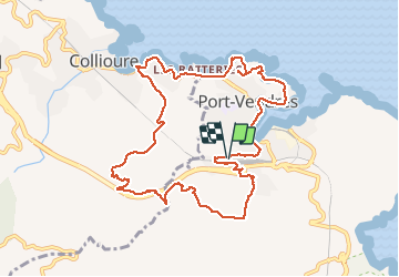

Length
12.1 km

Max alt
200 m

Uphill gradient
367 m
Km-Effort
16.9 km

Min alt
0 m

Downhill gradient
364 m
Boucle
Yes
Creation date :
2020-05-21 07:28:00.0
Updated on :
2020-05-21 13:23:00.426
3h21
Difficulty : Unknown

FREE GPS app for hiking
 SityTrail
IGN / Geographical institutes
SityTrail Plus
The world is yours!
About
Trail Walking of 12.1 km to be discovered at Occitania, Pyrénées-Orientales, Port-Vendres. This trail is proposed by robertperello.
Description
Ne pas prendre à droite aller plus loin jusqu’à la patte d’oie avant de rejoindre saint Elme
Photos

Positioning
Country:
France
Region :
Occitania
Department/Province :
Pyrénées-Orientales
Municipality :
Port-Vendres
Location:
Unknown
Start:(Dec)
Start:(UTM)
508422 ; 4706835 (31T) N.
Comments